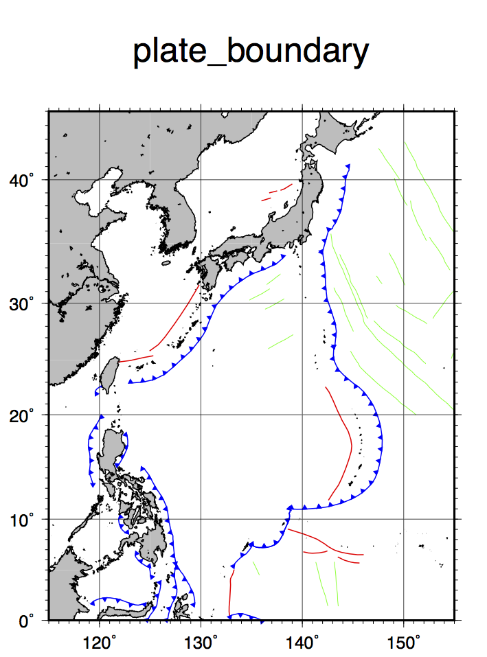
plot plate boundary 〜プレート境界を入れる 
 使うコマンド psxy
bash スクリプト例
# plot plate boundary
# parameter setting
region=115/155/0/45
# map region east/west/south/north
proj=M10
# map projection and scale
ticks=a10f1g10
# boundary tick info
frame=WSne+tplate_boundary
# boundary frame info
ridgefile=ridge.d
transfile=fracture.d
trenchfileL=trenchesL
trenchfileR=trenchesR
psfile=plate.ps
# output postscript file name
#
gmt psxy $transfile -R$region -J$proj -Wthinner,green -K -V > $psfile
gmt psxy $ridgefile -R$region -J$proj -Wthin,red -K -O -V >> $psfile
gmt psxy $trenchfileL -R$region -J$proj -Sf0.3/0.1+l+t -Wthin,blue -Gblue -K -O -V >> $psfile
gmt psxy $trenchfileR -R$region -J$proj -Sf0.3/0.1+r+t -Wthin,blue -Gblue -K -O -V >> $psfile
gmt pscoast -R$region -J$proj -Di -Wthin -Ggray -O -K >> $psfile
gmt psbasemap -R$region -J$proj -B$ticks -B$frame -O >> $psfile
#
Tips
- グローバルなプレート境界データは世間に出回っている(リンク集)。このスクリプトでは,海溝と拡大軸と主なフラクチャーゾーンをプロット(activeなトランスフォーム断層ではない).
- 海溝を寒冷前線マークで書きたい場合は、沈み込みの向きの情報が必要になる。GMTの寒冷前線マークは、線の右に三角を書くか、左に書くか
(-Sオプションの中の+rか+lか)で調べるので、海溝の位置が緯度経度の並びでずーっと入っているとすると、どちらが端点かによってオプションを変え
ないといけない。私の知る限り、それを分けてファイルとして提供しているサイトはないような。ただし、Birdのプレートモデルファイルは、各海溝位置
データのヘッダ部に向きの情報がアルファベットで入っているので、適当なスクリプトを書いて分割もしくはGMTの入力時に判断させることはできる。上記
は、事前に自分で左右を分けて別ファイルにしている場合のスクリプト。